What Affects Rates in Sandy
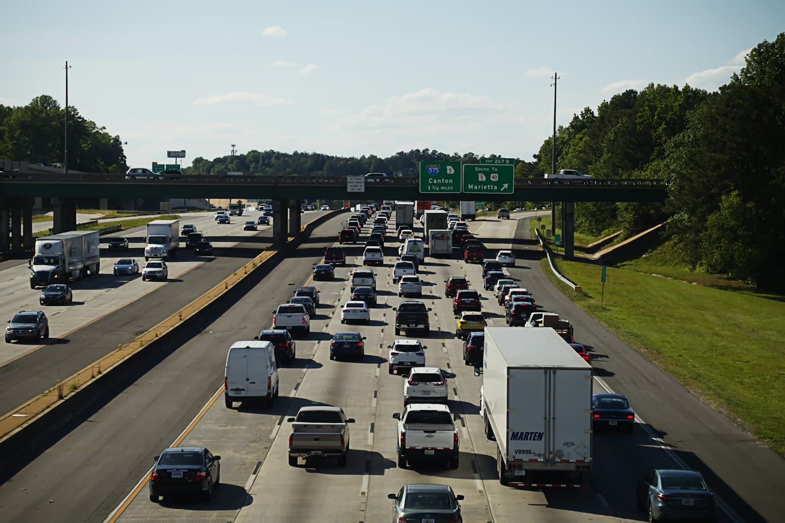
- The confluence of I-15 and I-215 at Sandy's northern edge creates one of the valley's busiest interchange zones, with peak commute congestion extending from 10600 South through the Midvale border. Collision frequency here runs 15–20% higher than city average. Drivers using this corridor daily typically see elevated comprehensive and collision premiums.
- Neighborhoods east of 1300 East near Dimple Dell and Bell Canyon foothills show lower theft and vandalism claims, while areas west of State Street toward the Jordan River corridor report higher property crime rates. The difference can shift premiums by $15–$30/mo for comprehensive coverage. Proximity to TRAX stations at Historic Sandy and Sandy Civic Center correlates with higher auto theft reports.
- Sandy's suburban layout means most residents commute 12–25 miles daily to Salt Lake City, Draper, or Utah County employment centers. Higher annual mileage pushes rates up compared to urban walkable neighborhoods. Drivers logging 15,000+ miles annually can expect 10–15% higher premiums than state baseline.
- Sandy's position on the Wasatch bench means elevated winter storm exposure compared to Salt Lake's lower valley floor. Snow accumulation and ice conditions on State Street, 9000 South, and eastside collector roads increase winter collision frequency. Comprehensive coverage sees more weather-related glass and body damage claims January through March.
- State Street through Sandy serves as a primary north-south arterial with dense retail, restaurants, and services generating constant cross-traffic and turning movements. South Towne Center and The Cairns shopping areas create pedestrian and parking lot collision hotspots. Drivers frequenting these zones face slightly elevated liability exposure.
Compare auto insurance rates in your state
Get matched with licensed carriers in minutes. One short form, real quotes, no obligation.
Get Your Free QuoteCoverage Recommendations
Cost estimates are based on available industry data and vary by driver profile. These are not insurance quotes.
Liability Insurance
Sandy's I-15 interchange and State Street corridor congestion increase rear-end and merge collision risk during commute hours.
$45–$75/moEstimated range only. Not a quote.
Full Coverage
Protects against frequent hail damage on the Wasatch bench and elevated theft rates near TRAX stations and retail corridors.
$90–$155/moEstimated range only. Not a quote.
Comprehensive Coverage
Sandy reports higher-than-average auto theft near transit stations and winter glass damage from bench-area storms.
$25–$45/moEstimated range only. Not a quote.
Collision Coverage
I-215 and 9000 South see elevated collision frequency during winter conditions and weekday commute peaks.
$50–$90/moEstimated range only. Not a quote.
Uninsured Motorist
Utah's uninsured rate hovers near 9%; Sandy's commuter traffic increases exposure to out-of-area drivers with unknown coverage.
$10–$20/moEstimated range only. Not a quote.